Precision Geospatial & Engineering Solutions
Geowayz Inc. delivers GIS LiDAR BIM Services USA infrastructure and engineering clients rely on for mapping, drone survey, and geospatial solutions.

Our Services
Our GIS LiDAR BIM Services USA team supports transportation, utilities, telecom, construction, and infrastructure projects with precision engineering workflows and scalable geospatial solutions.

GIS Mapping
Advanced Geographic Information System solutions for spatial data analysis and visualization.
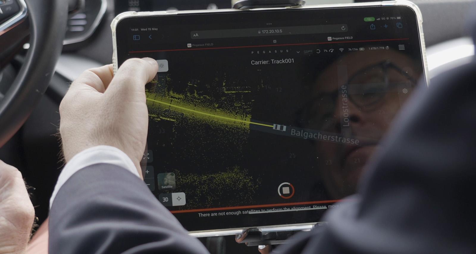
LiDAR & Mobile Mapping
High-precision 3D data acquisition using LiDAR and mobile mapping technologies.

Photogrammetry & Orthophoto
Aerial imagery and 3D modeling through advanced photogrammetric techniques.

CAD Drafting Services
Professional Computer-Aided Design (CAD) drafting for various engineering disciplines.
BIM Services
Building Information Modeling (BIM) solutions for integrated project delivery and lifecycle management..
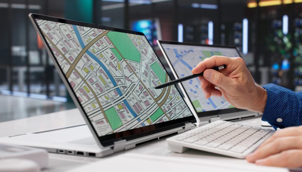
GIS Mapping & Analysis
Advanced Geographic Information Systems for data visualization and spatial insights.

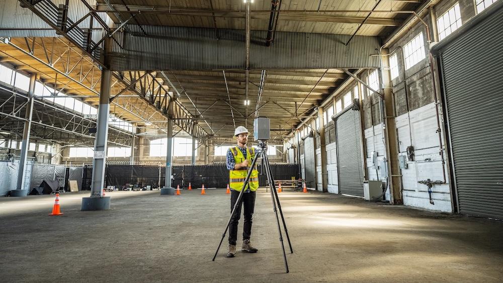
Precision Land Surveying
Accurate and reliable land surveying services for all project phases.

Civil Engineering Design
Innovative and sustainable civil engineering solutions for infrastructure development.

Remote Sensing & Drone Services
High-resolution aerial data acquisition and analysis using advanced drone technology.

Global Delivery Powered by Elucidate Technologies
Geowayz Inc. collaborates with Elucidate Technologies Pvt. Ltd., India, an ISO-certified geospatial and engineering solutions provider. This partnership enables scalable, high-quality, and cost-effective project delivery for clients worldwide.
ISO-Certified Excellence
Elucidate Technologies maintains international quality standards for all deliverables
Scalable Delivery Model
Access to a global team of experienced engineers and technicians
Cost-Effective Solutions
Optimize project budgets without compromising on quality
Industries We Serve
Specialized expertise across critical sectors
Infrastructure & Construction
Geowayz provides advanced geospatial solutions for planning, monitoring, and managing large-scale infrastructure and construction projects, ensuring efficiency and accuracy from conception to completion.
Engineering & Consulting
We empower engineering and consulting firms with precise mapping, data visualization, and analytical tools to enhance project design, feasibility studies, and client deliverables.
Government & Public Sector
Geowayz supports government agencies and public sector organizations in urban planning, resource management, emergency response, and public service delivery through robust geospatial intelligence.
Smart Cities
We provide the foundational geospatial data and analytical platforms necessary for developing and managing intelligent urban environments, optimizing services and improving quality of life.
Logistics & Supply Chain
ptimizing routes, tracking assets, and managing complex supply chains for maximum efficiency and cost savings.
Retail & E-commerce
Enhancing customer experience, optimizing store locations, and streamlining delivery services with precise geospatial insights.
Utilities & Infrastructure
Managing and monitoring critical infrastructure, planning network expansions, and ensuring service reliability w
Real Estate & Urban Planning
Providing data-driven insights for property development, urban planning, and market analysis to inform strategic decisions.
Why Choose Geowayz Inc.
Trusted by leading organizations across the United States
🎯
High Accuracy
Precision-engineered solutions meeting industry standards and client specifications
⚡
Fast Turnaround
Efficient project delivery without compromising on quality
🌍
Global Delivery Model
Scalable resources powered by ISO-certified partner Elucidate Technologies
👥
Experienced Team
Seasoned engineers and technicians with decades of combined expertise
Looking for reliable geospatial solutions?
Let’s discuss how Geowayz Inc. can support your next project